نظرة عامة على الدورة
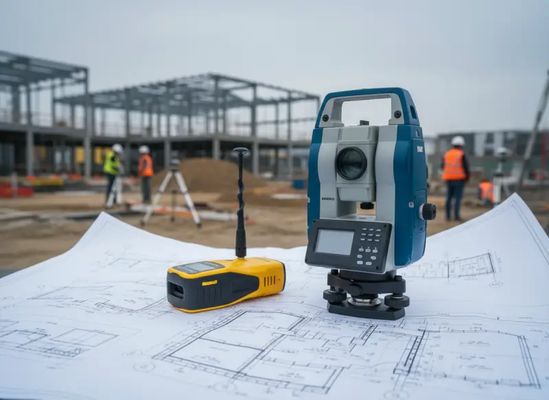
يقدم هذا البرنامج الشامل رحلة عملية المنحى في مهارات المسح المدني، مما يمكّن المشاركين من تعزيز قدراتهم في تقنيات المسح الميداني، تدريب توتال ستيشن، تدريب مسح GPS، أساليب برنامج تدريب الجيوماتكس، ومهارات مسح المواقع. صُممت هذه الدورة للمهنيين الذين يسعون لإتقان المسح الأراضي، المسح الأراضي المتقدم، والمسح العقاري، وتزود المتعلمين بالمعرفة اللازمة للمسح للمشاريع الإنشائية وسير العمل الهندسي الحديث.
خلال التدريب، يطور المشاركون أسسًا تقنية قوية في القياس، شبكات التحكم، التسوية، الترافرس، مسح الحدود، وجمع البيانات الطبوغرافية. تؤكد الدورة على التقنيات الكلاسيكية والمعاصرة، وتقدم التعرف على وظائف وقيود معدات المسح، الأدوات الرقمية، وسير عمل البيانات الميدانية. من خلال تطبيق أساليب المسح المنظمة على سيناريوهات العالم الحقيقي، يكتسب المتعلمون الثقة لدعم تطوير المواقع المعقدة، تخطيط البنية التحتية، تقسيم الأراضي، وتخطيط مواقع البناء.
يركز هذا البرنامج على الدقة، التحقق من صحة البيانات، الكفاءة الميدانية، والتفسير الفني—وهي جوانب أساسية للمساحين العاملين في بيئات البناء، الهندسة، المرافق، والتخطيط. من خلال الجمع بين الشرح النظري والرؤى العملية، تبني الدورة كفاءات موثوقة يمكن للمشاركين تطبيقها فورًا في مواقع المشاريع النشطة.
الجمهور المستهدف
- المساحون المدنيون
- فنيو المسح الأراضي
- مهندسو المواقع ومهندسو الإنشاءات
- فنيو نظم المعلومات الجغرافية والجيوماتكس
- مساعدو المسح العقاري
- فرق مسح البنية التحتية والطرق
- مهندسو مدنيون مبتدئون إلى متوسطي المستوى
- المهنيون المنتقلون إلى تدريب المساح المدني
الاقسام المستهدفة
- إدارات الهندسة والإنشاءات
- تطوير الأراضي والتخطيط العمراني
- أقسام مشاريع البنية التحتية
- إدارات الطرق والجسور
- أقسام المسح والجيوماتكس
- إدارات العقارات والمسح العقاري
- وحدات نظم المعلومات الجغرافية والخرائط
- إدارات مراقبة الجودة والتفتيش
القطاعات المستهدفة
- الإنشاءات والبنية التحتية
- العقارات وتطوير الأراضي
- أعمال الطرق والنقل
- منشآت النفط والغاز
- المرافق والأشغال العامة
- مشاريع التعدين والبيئة
- شركات المسح ورسم الخرائط
- الوكالات الحكومية العقارية والبلدية
أهداف الدورة
بنهاية هذه الدورة، سيتمكن المشاركون من:
- تطبيق تقنيات المسح الميداني للمهام الطبوغرافية والإنشائية
- أداء مهام تدريب توتال ستيشن بما في ذلك الترافرس، التوقيع، والتقاطع العكسي
- إجراء تدريب مسح GPS باستخدام معدات RTK وGNSS
- إجراء المسح العقاري لأغراض الحدود القانونية والعقارية
- استخدام مهارات مسح المواقع لأعمال الحفر، التسوية، المرافق، والتدرج
- حل مشاكل الهندسة الإحداثية لمهام المسح المدني
- دمج سير عمل برنامج تدريب الجيوماتكس في عمليات المسح
- إنتاج تقارير مسح دقيقة، خرائط، ومخرجات طبوغرافية
- دعم المسح للمشاريع الإنشائية من البداية حتى الانتهاء
- تنفيذ المسح الأراضي المتقدم للتضاريس الصعبة والمواقع المعقدة
منهجية التدريب
تستخدم الدورة منهجًا عمليًا وتفاعليًا يمزج الشرح المفاهيمي مع الأنشطة العملية الميدانية. ينخرط المتعلمون في مناقشات حالات، تمارين قائمة على سيناريوهات، ممارسة الهندسة الإحداثية، وحل مشكلات التوقيع لتعزيز مهارات المسح المدني. تقدم كل وحدة أمثلة توضح تقنيات المسح الميداني، تدريب توتال ستيشن، تدريب مسح GPS، وتطبيقات المسح الأراضي المتقدم. على الرغم من عدم توفير الأدوات، يتلقى المشاركون شرحًا تفصيليًا، عروضًا توضيحية، وأمثلة ذات صلة بالميدان لمساعدتهم على تطبيق مهارات مسح المواقع مباشرة في بيئات المشاريع الحقيقية.
أدوات الدورة
- قوائم مراجعة مهام المسح
- قوالب الهندسة الإحداثية
- نماذج العمل الميداني الطبوغرافي
- دليل إعداد نقاط التحكم
- قوالب جمع البيانات
- أوراق عمل التوقيع وتخطيط المواقع
- رسومات عينات وهياكل خرائط
- أوراق مرجعية لدقة المسح
محتوى الدورة
اليوم الأول: أسس المسح المدني والأراضي
- الموضوع 1: تقنيات المسح الميداني الأساسية وأساسيات مهارات المسح المدني
- الموضوع 2: فهم قياسات المسح: المسافات، الزوايا، الارتفاعات، والإحداثيات
- الموضوع 3: إنشاء شبكات التحكم، نقاط الارتفاع المرجعية، والترافرس للمسح الأراضي
- الموضوع 4: مقدمة في المسح العقاري وتحديد الحدود القانونية
- الموضوع 5: مهارات مسح المواقع الأساسية لإعداد البناء والمحاذاة
- الموضوع 6: مبادئ الدقة، مصادر الأخطاء، وتقنيات التحقق من صحة القياس
- تأمل ومراجعة: ملخص مبادئ المسح الأساسية ونقاط التعلم الرئيسية
اليوم الثاني: عمليات توتال ستيشن والتوقيع المتقدم
- الموضوع 1: إعداد توتال ستيشن، معايرته، والتعامل مع المعدات
- الموضوع 2: قياس الزوايا، EDM، الترافرس، وسير عمل التقاطع العكسي
- الموضوع 3: مهام التوقيع الإنشائي: المحاور، الإزاحات، المستويات، وإجراءات التوقيع
- الموضوع 4: اكتشاف الأخطاء وتصحيحها في عمليات توتال ستيشن
- الموضوع 5: استخدام محطات توتال ستيشن الروبوتية واللاعاكسة في المسح الأراضي المتقدم
- الموضوع 6: تسجيل، تخزين، ونقل البيانات الميدانية للمشاريع الإنشائية
- تأمل ومراجعة: مراجعة أساليب توتال ستيشن المطبقة ودقة التوقيع
اليوم الثالث: مسح GPS/GNSS ودمج الجيوماتكس
- الموضوع 1: أساسيات تدريب مسح GPS ومفاهيم تحديد المواقع عبر الأقمار الصناعية
- الموضوع 2: سير عمل مسح RTK GNSS وإجراءات معايرة الموقع
- الموضوع 3: تقنيات دمج بيانات GPS مع أدوات برنامج تدريب الجيوماتكس
- الموضوع 4: ضمان الجودة لتحديد المواقع بنظام GNSS، تجنب المسارات المتعددة، وتخفيف الأخطاء
- الموضوع 5: استخدام GNSS لجمع البيانات الطبوغرافية، رسم خرائط المرافق، ومسح الطرق
- الموضوع 6: معالجة البيانات، تحويل الإحداثيات، ودمجها في الخرائط الرقمية
- تأمل ومراجعة: مقارنة بين سير عمل GPS وتوتال ستيشن وأفضل التطبيقات
اليوم الرابع: المسح الطبوغرافي، العقاري، والإنشائي
- الموضوع 1: إجراء المسح الطبوغرافي وإنشاء نماذج التضاريس
- الموضوع 2: المسح العقاري لحدود الملكية، تقسيم الأراضي، والتوثيق
- الموضوع 3: المسح للمشاريع الإنشائية بما في ذلك التحكم في أعمال الحفر وتخطيط المرافق
- الموضوع 4: التقاط وتشفير المعالم الميدانية لتطبيقات رسم الخرائط والتصميم
- الموضوع 5: إنشاء رسومات طبوغرافية، طبقات، وسير عمل من الميدان إلى المكتب
- الموضوع 6: مراقبة الجودة، فحوصات الدقة، وتقنيات التحقق النهائي
- تأمل ومراجعة: دمج البيانات الطبوغرافية والعقارية لاتخاذ القرارات الإنشائية
اليوم الخامس: المسح التطبيقي، حسابات الهندسة الإحداثية، والتوليف الميداني
- الموضوع 1: حسابات الهندسة الإحداثية (CoGo) لتخطيط التوقيع وحل المشكلات
- الموضوع 2: إدارة مهارات مسح المواقع في البيئات المتقدمة والمقيدة
- الموضوع 3: سير عمل المسح الشامل من الاستطلاع إلى رسم الخرائط النهائية
- الموضوع 4: التحديات العملية: العوائق، السلامة، الطقس، والتعقيدات الواقعية
- الموضوع 5: تقنيات المسح الأراضي المتقدمة لتنسيق المشاريع متعددة المراحل
- الموضوع 6: التطبيق الميداني النهائي: تخطيط، تنفيذ، وتوثيق مهمة مسح كاملة
- تأمل ومراجعة: تقييم الكفاءة، استخلاص معلومات المشروع، واختتام الدورة
الأسئلة الشائعة
ما هي المؤهلات أو المتطلبات المسبقة المحددة المطلوبة للمشاركين قبل التسجيل في الدورة؟
يستفيد المشاركون من امتلاك فهم أساسي لمبادئ البناء أو الهندسة. الخبرة السابقة في القياسات الميدانية أو أعمال الموقع مفيدة ولكنها ليست إلزامية.
كم مدة كل جلسة يومية، وهل هناك عدد إجمالي من الساعات المطلوبة للدورة بأكملها؟
تم تصميم كل يوم ليتضمن 4-5 ساعات من التدريب مع فترات راحة وعناصر تفاعلية. تستمر الدورة لمدة 5 أيام، بإجمالي 20-25 ساعة تدريبية.
لماذا تختلف القياسات أحيانًا بين مخرجات GPS وتوتال ستيشن؟
تنشأ الاختلافات بسبب هندسة الأقمار الصناعية، العوامل الجوية، قيود خط الرؤية، ومعايرة الأجهزة. هذه الاختلافات طبيعية ويمكن إدارتها عند اتباع الإجراءات الميدانية الصحيحة.
كيف تختلف هذه الدورة عن دورات المساح المدني الاحترافية الأخرى؟
يركز هذا البرنامج على الجاهزية للواقع العملي من خلال مزج تقنيات المسح الميداني، تدريب مسح GPS، وتدريب توتال ستيشن في إطار عملي يحاكي الظروف في الموقع. على عكس دورات المسح الأراضي التقليدية التي تركز على النظرية وحدها، يربط هذا التدريب كل موضوع ببيئات البناء الحقيقية، مما يمكّن المشاركين من تطبيق مهارات مسح المواقع مباشرة على تطبيقات الحفر، المرافق، التسوية، التوقيع، والحدود.
توفر الدورة أيضًا تعرضًا متقدمًا لممارسات برنامج تدريب الجيوماتكس، مما يعد المشاركين للعمل بثقة مع سير عمل المسح التقليدي والرقمي. خلال الجلسات، ينخرط المشاركون في مهام تحليلية، التحقق من صحة البيانات، وتحديات اتخاذ القرار التي تواجه عادة في المسح للمشاريع الإنشائية.
بحلول نهاية هذه الدورة، يمكن للمشاركين تخطيط مهام المسح الكاملة وتنفيذها والتحقق منها بشكل مستقل—مما يجعل هذا البرنامج يتميز كتجربة تدريب مساح مدني رفيعة المستوى وقائمة على الممارسة.